The peak of Stožina is located on the territory of the Durmitor National Park above the Pošćenska dolina. This is far from the highest point of Durmitor, however, due to its picturesqueness, it has become one of the symbols of the national park and one of the most frequently photographed peaks. It is called the gateway to South Durmitor.
Visiting the location Ćurevac
Ćurevac (also sometimes there is a variant of Ćurovac) it is a mountain peak and an viewpoint of the same name above the village of Tepca in the eastern part of the Tara River canyon. It is located on the territory of the Montenegrin national park Durmitor and is one of its most famous viewing points.

Ćurevac - time to visit
Viewpoint Ćurevac is available for visits at any time of the day - it is open all the time, it has no fixed opening hours.
The most comfortable time to visit is the period from April to the second half of November.
How to get to Ćurevac
The place is located 7.5 km from Zabljak. I must say right away that no public transport goes to this area.
Most of the way - or rather, 6.5 km, can be overcome by car.
Slightly more than half of this distance is a forest road. It is covered with asphalt. The surface of the road is old and quite broken in places, but it is quite possible to drive along it in an ordinary city car, just not very fast.
There is only one lane for both directions, but due to the fact that the path passes through relatively flat terrain and through the forest, there are enough exits on the road (to allow oncoming cars to pass). In addition, other cars on this route are rare (although the situation still largely depends on the month and time of day).

There are a couple of signs on the road with the name of the viewpoint and directions. You can also focus on the village of Tepca (Ćurevac will be less than halfway to it from Žabljak).
The point is marked in map applications (google maps, maps.me), the easiest way is to lay a route directly to the beginning of the trail and and follow it. True, in maps. me, not only is the official footpath marked, but the wild paths to the top, so be careful.
You will recognize the place from which the most popular, simple and picturesque trail starts from a small wooden house in which the cashier and the national park ranger sit, as well as a sign with the name of the location.
The cost of visiting the viewpoint Ćurevac.
If you have not yet paid for your stay in the national park, you will need to do it here (I remind you that a day in the Durmitor National Park currently costs 3 €). Provided that the visitor already has a ticket, no additional fees are charged.
In the cold season, the ticket office, by the way, may be closed.

Infrastructure at the viewpoint in NP Durmitor
There is a parking area next to the ticket office. Places are not marked, parking is free.

There is also a small seating area and a cafe open in summer.

Ćurevac in Durmitor - hiking
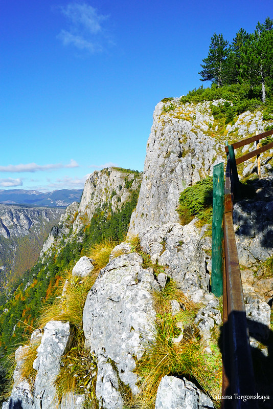
Almost right behind the ticket office, the ascent begins, in this place it is fenced with a pretty wooden fence.

From here there is a breathtaking view.

The trail passes through roots and rocks. The rise on this stretch is sharp, but short.

The place is very atmospheric. The path and the fence enclosing it are located in the shade of pine trees right at the cliff, from where a great panorama opens up. It is simply impossible to resist and not stop for a couple of minutes.
Often, tourists are generally limited to just a view from this point, take a photo and come back. However, this is only the very beginning of the walking route, and the main observation deck is located at its end.

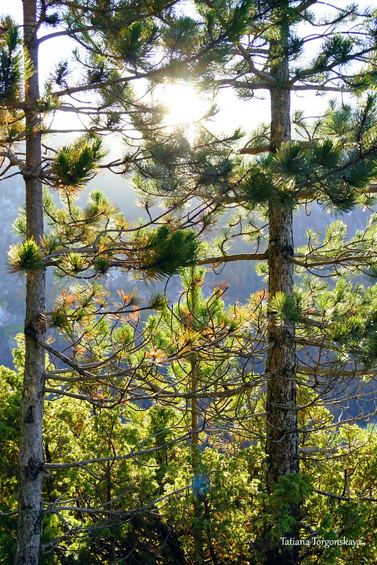
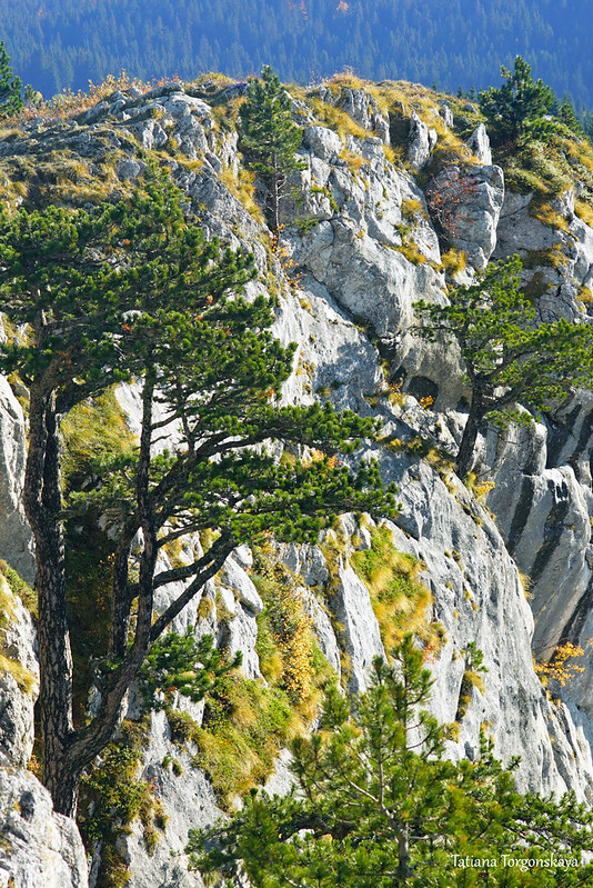
The first half of the way passes through the evergreen forest.

Walking along it was a pleasant surprise for me. The forest turned out to be absolutely wonderful - coniferous, picturesque and unusual in its own way.
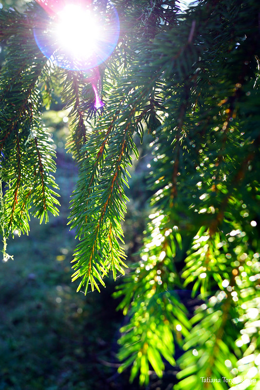
Its peculiarity is that it mixes different types of coniferous trees and shrubs, harmoniously combined and making the picture interesting.

On one small piece, sometimes you can see a whole mix of twigs with needles of various lengths, hardness and colors.
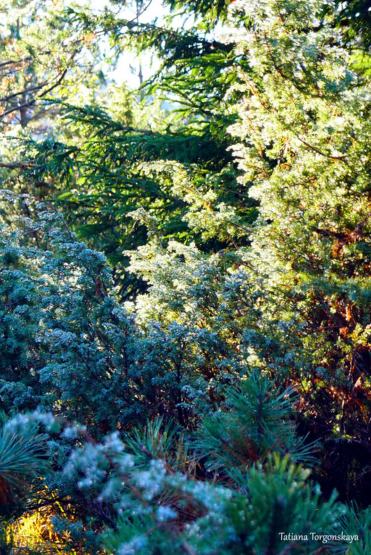
There are several types of fir trees.

Some of them, by the way, grow in an absolutely incredible way on rocky vertical slopes.

Quite a lot of pines are also found.


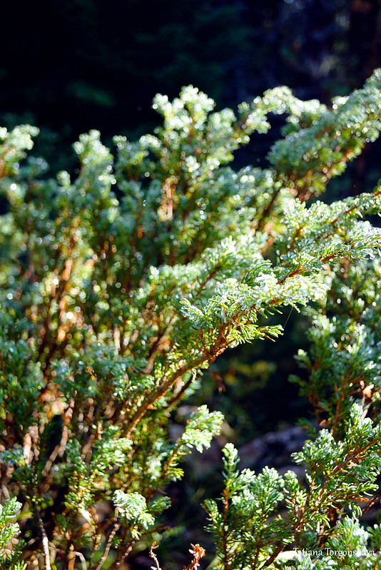
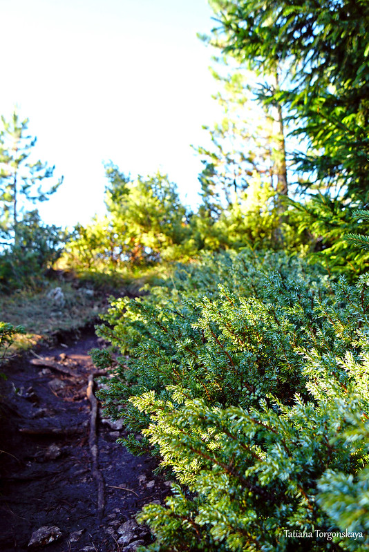
They are complemented by different types of juniper, which occupied the lower level.


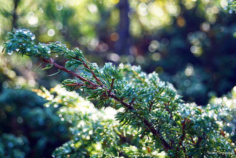
Juniper bushes can decorate dark blue berries.

And some trees of this forest are covered with light green lichen - plum evernia (or oak moss).

He can be accompanied by Tillandsia usnea, better known as Spanish moss. Together they bring a certain fabulousness to the landscape, and sometimes mysticism.
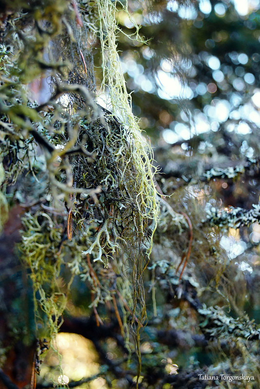
By the way, lichens are an indicator of the purity of the air. Although even without this, it is obvious that the ecology in the national park is very good.

Texture on the trunk of one of the trees on the path.

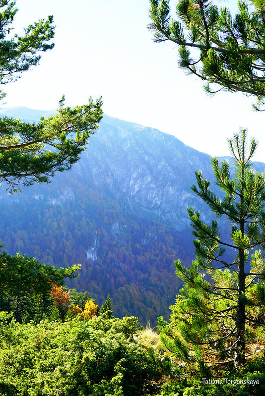
The trail almost all the time goes close enough to the cliff, so from time to time you can turn off it a little and admire the panoramas that open up.
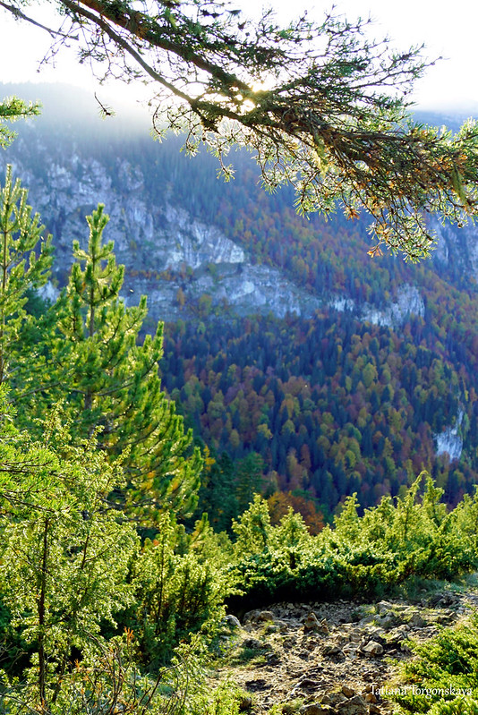
View down.

A look to the south and to our goal. The viewpoint is at the top of the far cliff.

Despite the fact that the route begins promisingly (a fence that fits into the surroundings, a recreation area, wooden signs), the trail equipment ends very quickly. It is not even marked - the path is just a path trodden by tourists.

To be more precise, there are several paths in the forest, but they all lead more or less in the same direction and the main path usually stands out - the road that people walk on more often, as a rule, is cleaner and wider.
The total length of the trail is 1 km.

As for the degree of difficulty, it can be classified as an easy mountain route. This should be affordable even for people without special physical training, including families with children and the elderly. It's just that in these cases it is worth laying a little more time for hiking.

At a normal pace, with a couple of short stops, the walk takes about half an hour. If you walk quickly and without pauses, it is quite possible to overcome the distance in 20 minutes.
There will be no dangerous sections along the way, provided that you do not create risks for yourself (come close to the cliff).

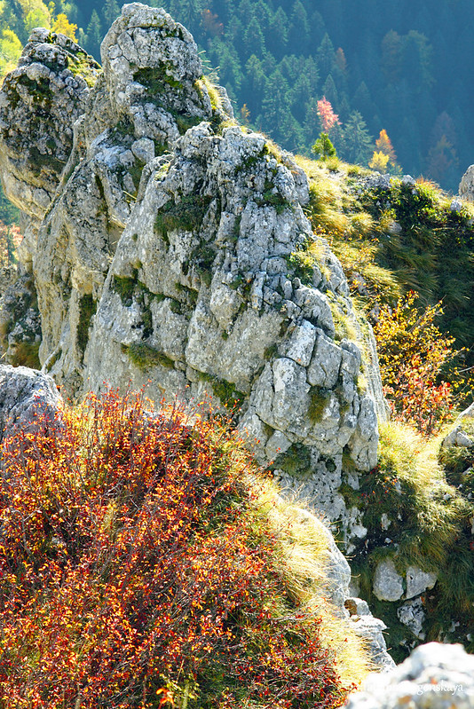
About half of the route passes through the forest, and the rest of it lies in open areas. There are few trees in it, but there are still many junipers.

Due to the low vegetation from here a good overview of the surroundings.
Looking north to where we started our hike.

View in the opposite direction.

Landscape towards the canyon due to thickets of juniper.

Another look down at the forest below the mountain. To him, by the way, about 600 meters.

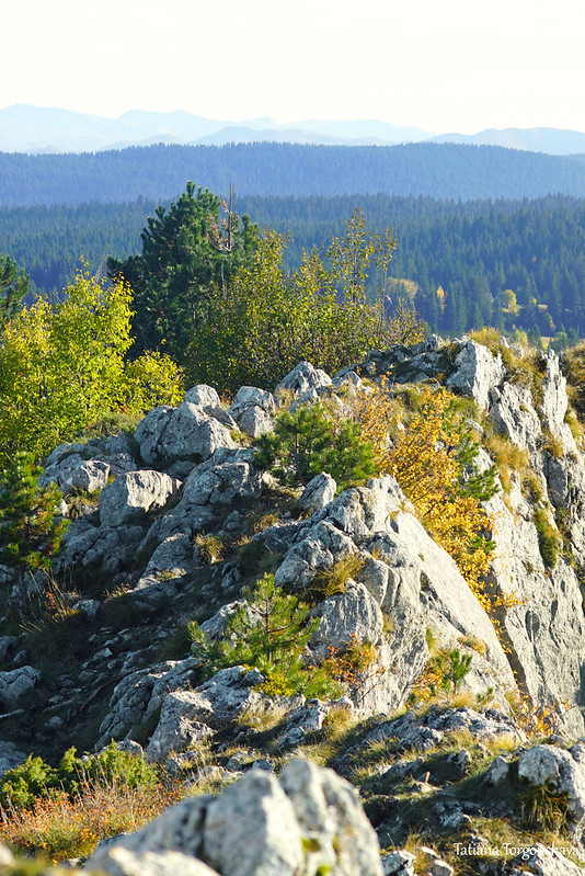
Final section of the trail.

At the end, you will have to climb a small hillock.
At the final place of the route there is a sign with the name of the national park. Previously, there was a bench here, but at the time of our trip (autumn 2021), unfortunately, only traces of fastening remained from it.

The top of the mountain itself is an uneven rocky area.

Ćurevac has a height of 1625 meters above sea level.
The name of the peak, by the way, is derived from the word "ćuriti" which can be translated as "look", "stare". It is said that earlier shepherds often lingered here to admire the view of Tara, hence the name.

The panorama from here is really good.

The view of the western part of the canyon, however, is not much different from what could be seen at the beginning of the walk.

Mountains on the opposite bank of the river.

And here is Tara. It should be noted that in the morning it often looks more spectacular and brighter. In the afternoon, this section of the river gradually sinks into shadow and loses its color.
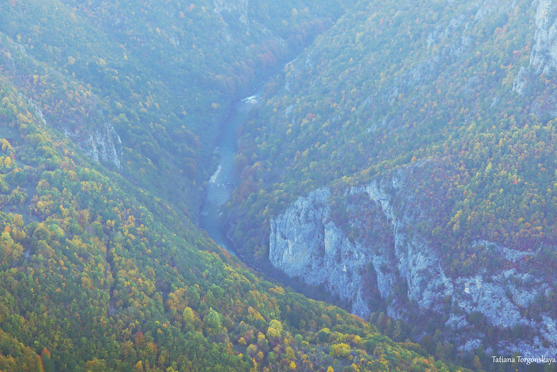
But the previously invisible eastern part of the canyon in the afternoon is perfectly observed.

River close up.

Picturesque rock above it.

Looking east. Behind the dense coniferous forest one can see other hills and small houses.


The slope of the mountain on top of which we are.

And to conclude the post - another look down from the cliff.
Other publications about the Durmitor National Park on this site:
Comments
Post a Comment