The peak of Stožina is located on the territory of the Durmitor National Park above the Pošćenska dolina. This is far from the highest point of Durmitor, however, due to its picturesqueness, it has become one of the symbols of the national park and one of the most frequently photographed peaks. It is called the gateway to South Durmitor.
In the last post, which was about hiking to the top of Savin kuk, we stopped at the finish area of the ski lift. From here we will continue on our way.
In the photo you can see the goal of the route - this is the top above a small house, standing at the end of the cable car.
By the way, strictly speaking, the top point of the mountain is called Kulina, directly Savin kuk is located below. But as tourism develops, the old name is more and more forgotten, and the toponym Savin kuk is even more firmly attached to the peak. It is under it that it is indicated on modern maps and signs. I will also use the name Savin kuk - it's easier and less confusing.
In general, the mountain was named after the most revered saint of the Serbian Orthodox Church - Sava. According to legend, he rested in this place and he really liked it.
A hundred meters below the top point, at an altitude of 2212 meters above sea level, there is a drinking spring, also associated with the name of St. Sava - Sava's water. It will be shortly after the lift, right next to the trail.
According to folk legend, the spring arose after Sava christened the earth with his staff.

Some people still believe that water has healing properties. Every year on Ilyin's Day, August 2, a group of pilgrims rises here.
People collect water in a bottle and store it until next year. She does not deteriorate all this time and serves as a talisman against bad influences.
Also, water from the source is drunk in the hope that it will give health, happiness and peace.
Nowadays, the spring is used not only by religious people, but also by tourists walking along the trail who want to quench their thirst.

Near the source there are several wooden benches.

They are at different heights, so everyone can choose their location and view to taste.

This is the perfect place to relax or have a snack. 

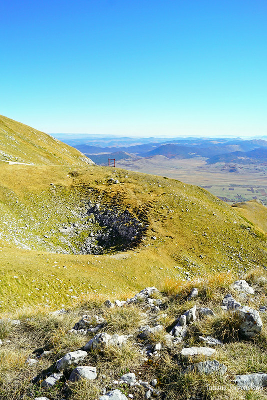
There is a large square wooden frame in front of the upper bench. Because of it, some tourists think that they have already climbed to the top.
In fact, the height here is less, and the top itself is farther. It will take another 10-15 minutes to walk to it.

But before heading up, we will approach the pass between the Šljeme ridge and Savin kuk.
It ends with a rather steep cliff, so it is better to keep some distance from the edge.

You can take a little walk along the wild path to the left and come close to the ridge.
View from there to the resting place with a frame.
Landscape with the top of Bobotov kuk (it is located on the left side of the picture. This is the highest point of Durmitor and in the photo, in fact, it is also the highest).

Looking towards the restaurant "Momčilov grad". The restaurant itself is recognizable by its green roof, visible even from this distance.

If you look down from the pass, you can see not only steep rocks, but also a climbing cable stretched down. Or rather, there are even two of them. In this picture, the old one, and a little higher and to the right there is a brand new one, more convenient and safe for descent.

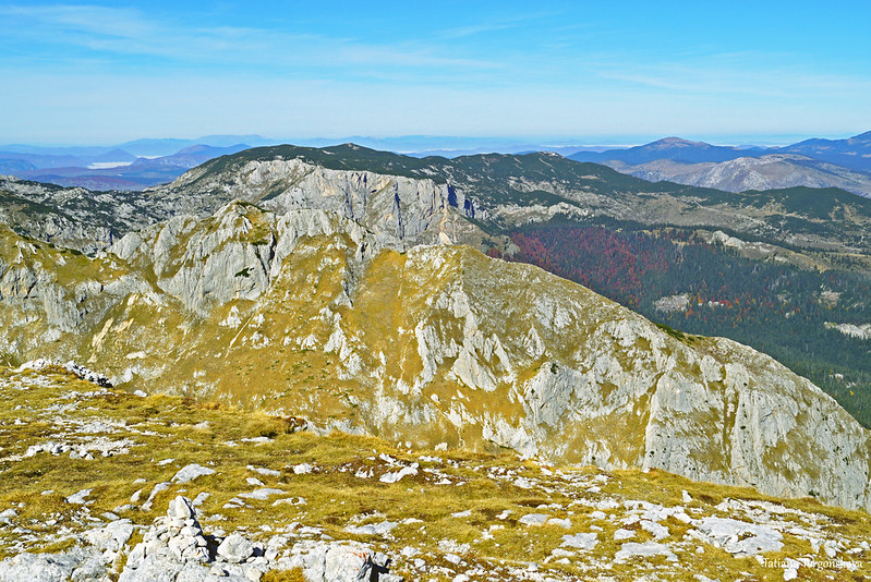
General view. The hill in the foreground, which occupies the entire right side of the frame, is our Savin kuk.
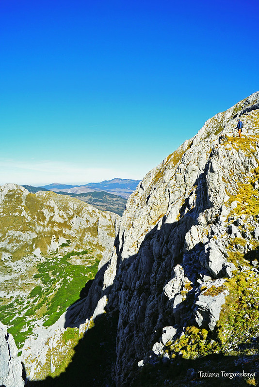
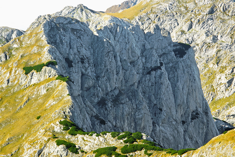
A couple of close-ups of Šljeme.

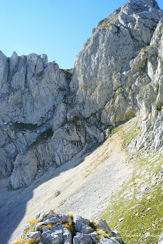
After enjoying the panorama, we continue our way up.
To facilitate the ascent, the path is laid in a zigzag pattern. But if you wish, you can shorten the route in some areas and go directly, since this part of the mountain is safe and relatively easy to climb.

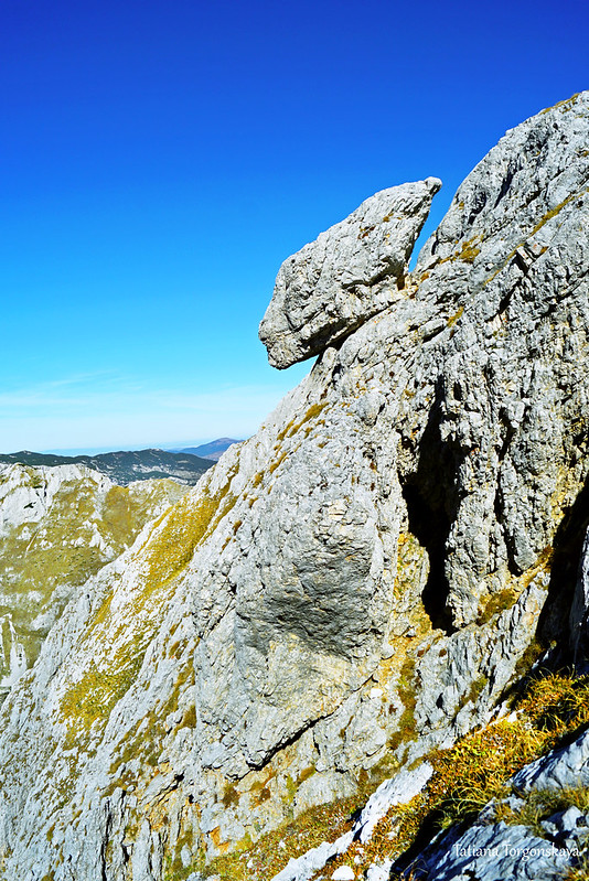
Unusual stone on the western slope.
Looking down from the path.

The top will meet you with several cairns.

And, of course, amazing panoramas.
From the top of Savin kuk, a significant part of Durmitor and several of its famous sights are visible.
First of all, this is the Black Lake.
The small body of water that we see behind it is Lake Barno.

Panorama with the city of Žabljak and its environs.

Šljeme and the Debeli namet glacier, located on its slope (by the way, the glacier was also visible from the pass, but from the top a better angle).

Let's take a closer look at the landscape.

Here is Terzin Bogaz (2303 m above sea level).
In this photo on the left - the same Bobotov kuk (2523 m above sea level).
On the right, slightly inferior to it in height - Bezimeni vrh (2487 meters above sea level).

Landscape to the left of the summit of Bezimeni vrh.

Šljeme, Eastern peak (there are three in total near the ridge).

A long ridge, on the sides of which there are bare rocks, and on top of a green forest - this is Crvena greda.

Black Lake.

View of the Bosača village.

View towards the canyon of the Tara River. The canyon can be identified by low clouds.

Different parts of the Lake Plain.


And numerous mountain slopes and peaks, limiting the plain from the opposite side.

There are no marked hiking paths from Savin kuk to other peaks, so after resting and looking around the surroundings, you will have to go down the same way.
However, before returning, you can still walk along the hillside in the opposite direction. The panoramas will remain about the same, but it will be possible to see Savin kuk from a new perspective.
The way to the point with this view will take about 5 minutes.

After that, you can definitely go back and go down the mountain on the lifts (if they work) or on foot along the path marked with red and white marks.
Comments
Post a Comment