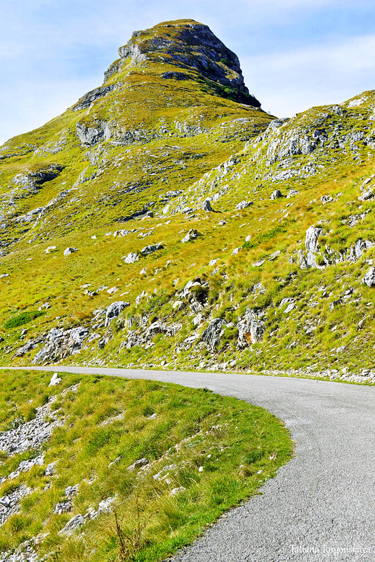
The peak of Stožina is located on the territory of the Durmitor National Park above the Pošćenska dolina. This is far from the highest point of Durmitor, however, due to its picturesqueness, it has become one of the symbols of the national park and one of the most frequently photographed peaks. It is called the gateway to South Durmitor.
The peak of Stožina is located on the territory of the Durmitor National Park above the Pošćenska dolina. This is far from the highest point of Durmitor, however, due to its picturesqueness, it has become one of the symbols of the national park and one of the most frequently photographed peaks. It is called the gateway to South Durmitor. 
The name of the mountain was formed from the word "stožer". This is the name of the pillar around which the horse walks while grinding grain. Previously, the peak reminded people of it, but today it is more often compared to a haystack.
The height of Stožina is 1908 m above sea level.
There is not a single tree on the mountain, only grass covers the stones, and rare low juniper bushes.
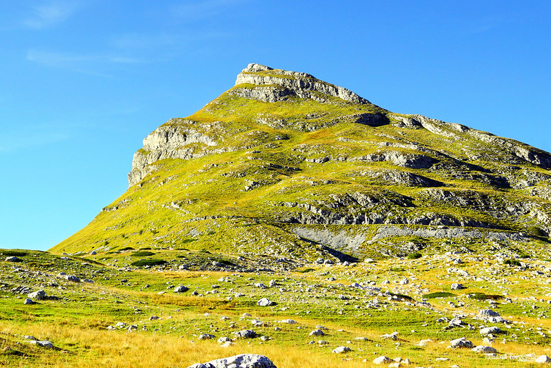
Depending on the angle, the view of the top can be very different.

It looks most impressive from the east side. For example, from the road leading from Žabljak to Trsa (Plužine).

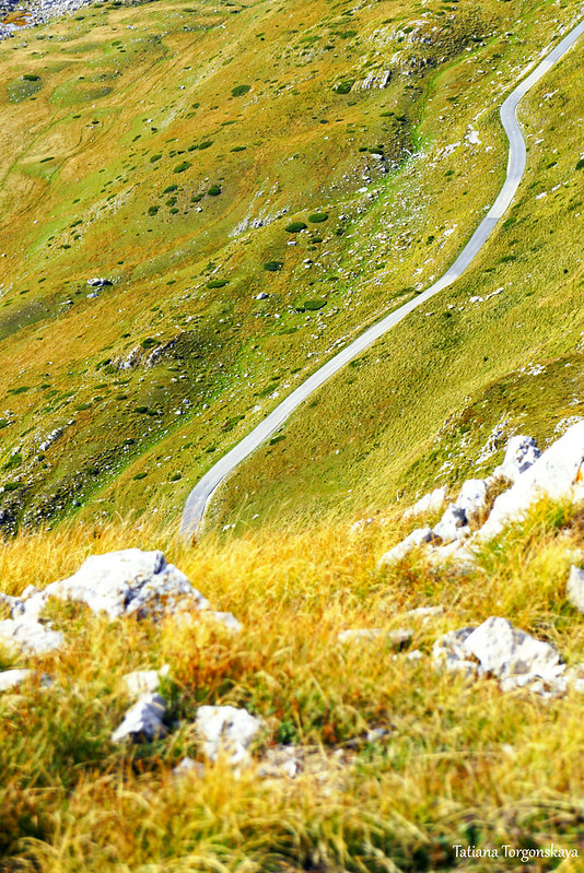
In general, due to the fact that a road passes under the top, it is quite easy to get close to it - it will turn out to drive up close and the road up will take relatively little time.
It is best to park the car in a parking lot above Suva lokva lake (theoretically, you can park your car a little further away, on the side of the road. But you should not do this so as not to interfere with others - the road here is narrow, and the sections that may be needed for passing, it would be better not to borrow).
After parking, those who want to climb to the top will need to take a little walk along the road ahead.

And when you get very close to the top, start climbing up.
Unfortunately, there is no designated route to Stožina yet. Although the views from it are very good and the way up is not the most difficult if you know where to go. 
In places, a well-trodden path is visible, but it is not always obvious. So tourists who want to climb up, part of the time have to lay the route on their own.

However, at the first stage, there are no difficulties due to the fact that the goal of the ascent is visible and where to step is more or less clear, and the ascent itself, although sharp, is not dangerous.
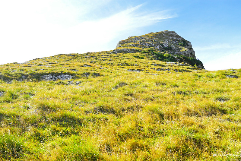
Almost from the very beginning of the journey, beautiful landscapes please the eye.
Here is a piece of Suva lokva lake.

View of the road we were on.

The slope of Stožina and the Ranisava ridge behind it.

Landscape in the north.

Looking northeast.

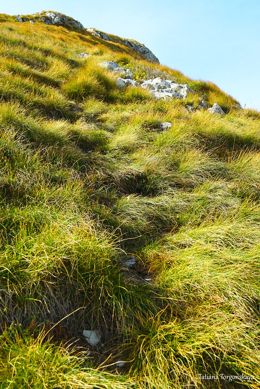
From afar it seems that the whole mountain is covered with the same yellow-green grass, but close up it becomes noticeable that the vegetation here is quite diverse. So sometimes it can be quite interesting to look under your feet too.

If the path had been marked out, it would have been a pure pleasure to go upstairs. And so, of course, you have to periodically be distracted in order to figure out how best to get through. This is a minus of climbing to this single peak. This is the only downside to climbing to the top.
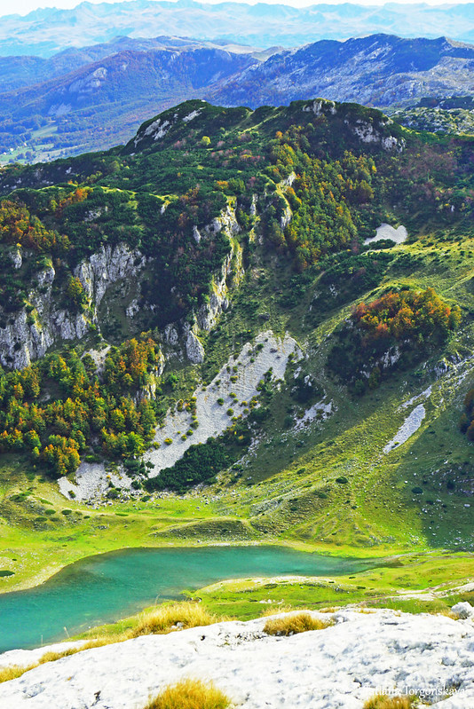
Stožina is one of the points that allow you to appreciate the richness and diversity of Durmitor. You can also see forests from it; and small, but fascinating with their color lakes;

and more or less gently sloping elephants, overgrown with bright grass;

and green valleys with low, cozy mounds;

and sharp mountain ranges with steep peaks.

The most difficult section of the ascent is the final one. To a greater extent, not because it is sharp, but because there is a great risk of going astray from the right direction. It is worth sticking to the edge of the ridge, not moving sideways and not trying to climb the mountain from other sides - climbing there becomes very, very dangerous. One wrong step - and you can fly far down.

At the end, you should go strictly on the left side, near the cliff. This is the safest way.

Those who are not afraid of difficulties, as a reward, an excellent 360-degree view awaits at the top.
Here, first of all, you can admire the western side landscape, which was not visible during the ascent.

Looking in the opposite direction.

Pošćenski Kraj.

South side.

A few close-ups: a piece of Suva lokva lake and beautiful mountains above it.
And this is a look in the direction of Modro lake located a little further away .

The area known as Provalija.

Pošćensko lake.

Lake surroundings.

Mountain landscape north of Stožina.

Road leading to Trsa.

And a few more nearby slopes and peaks in the end: beautiful both in the complex and separately.


The ascent to Stožina takes about 40 minutes if you walk at an average pace. Going back down the road will take about the same time.
Comments
Post a Comment